CIIC 161. Ballintaggart VII (Baile an tSagairt), Co. Kerry
Download Epidoc | 3D PDF | 3D OBJ | 🔗 URI https://ogham.celt.dias.ie/161._Ballintaggart_VII
Site Type
Ecclesiastical
Description
Site
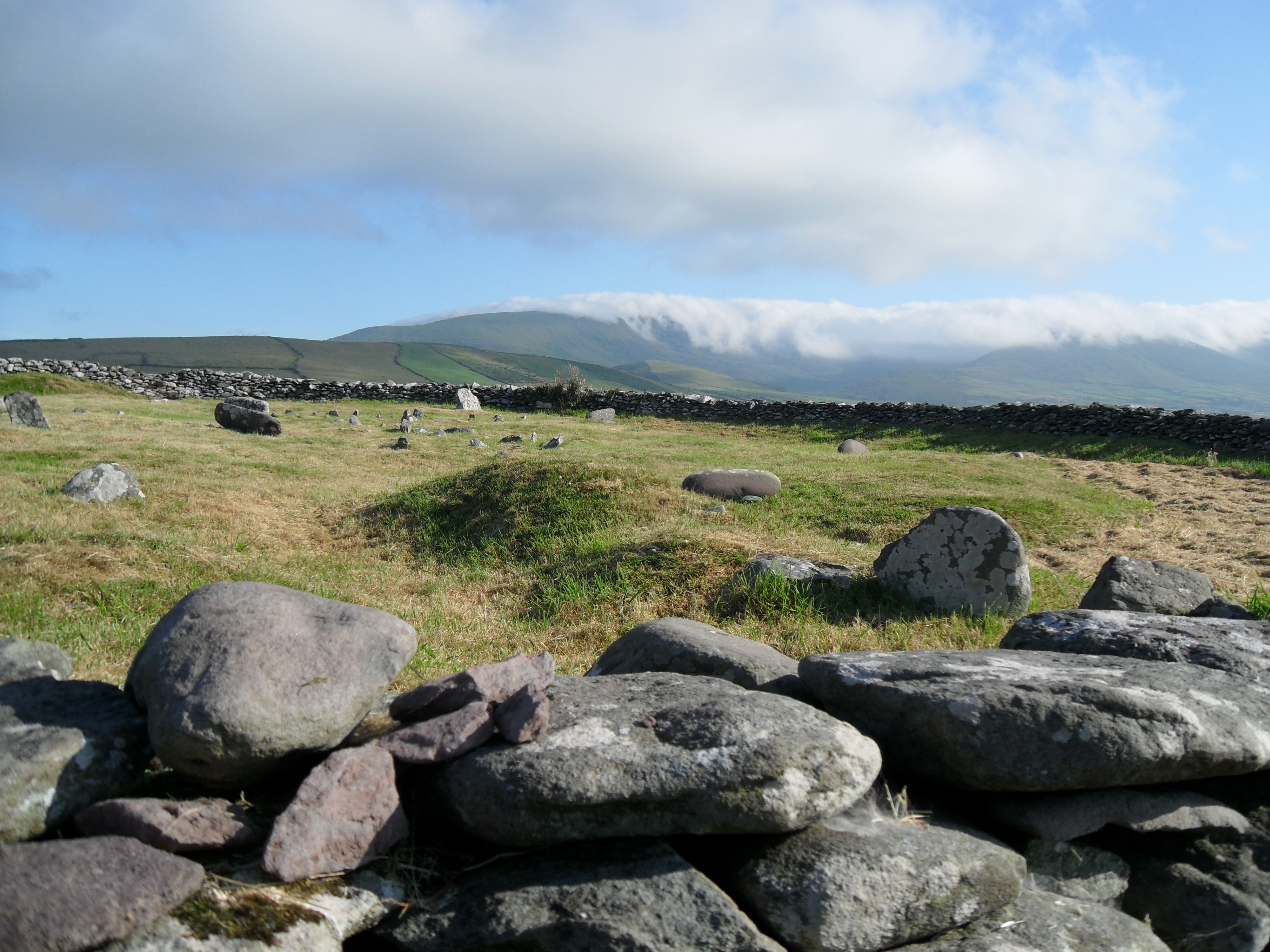
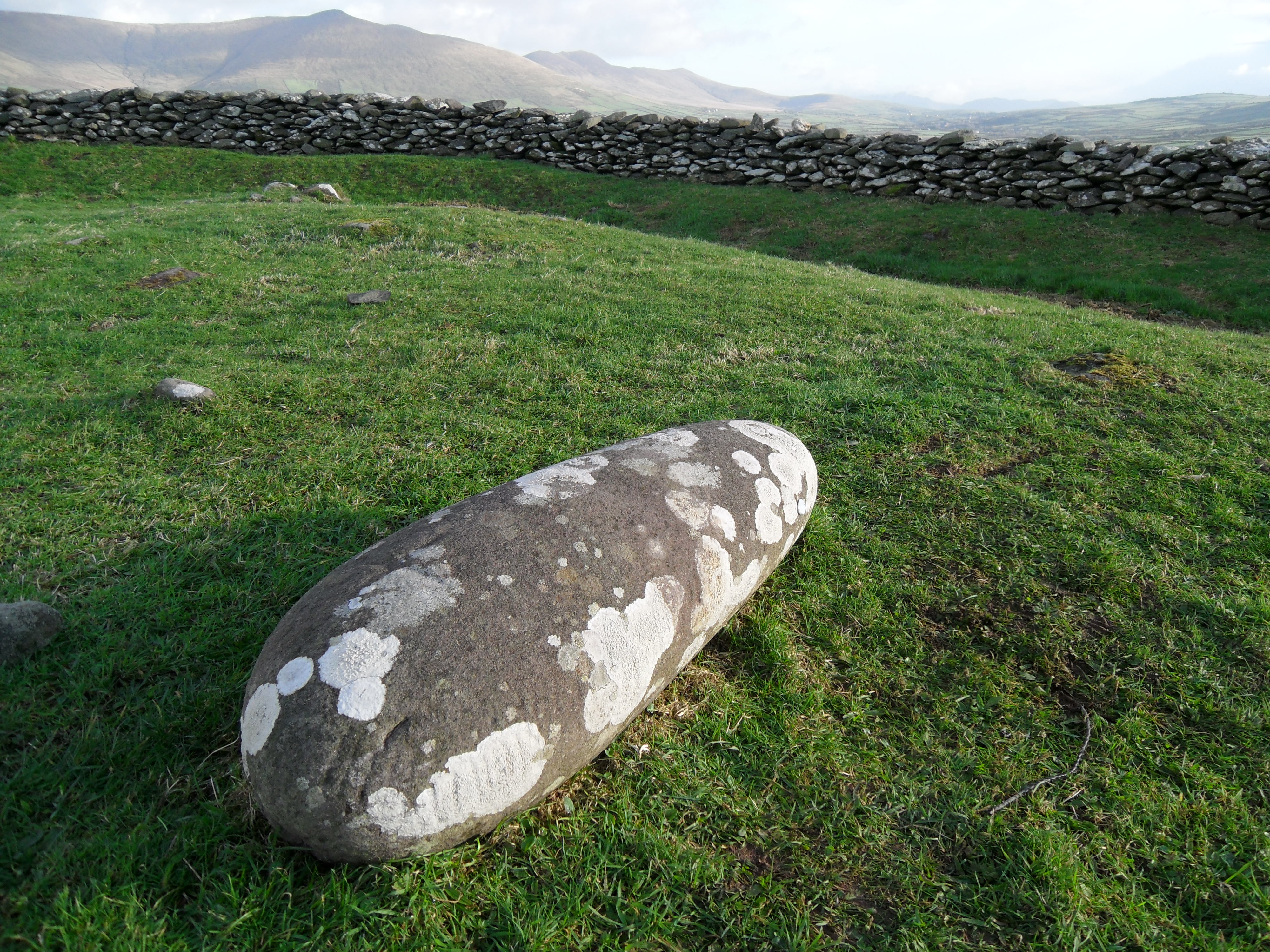
Site of church and old burial gound (An Cheallúnach or An Lisín). 'This circular enclosure crowns the summit of a low, but prominent, hillock between Dingle Harbour and Trabeg. The site of a church is shown within the enclosure on the OS maps, but nothing more is known about this, and no visible trace survives. Children were still being interred there in the burial ground in the mid-19th century' (Cuppage et al 1986, 264). The current stone enclosure, approximately 30m in diameter, is 'only a portion of the original site and was built up by a landlord sometime prior to 1847' (Devane 2001, 372). Macalister (1945, 151-7) recorded nine ogham stones collected together at the site. These 'mostly pulvinar' or oval water-rolled boulders resemble the stones found 'about 6 miles away' at Minard storm beach. Eight of the nine stones are now arranged in a circle within the stone enclosure with the ninth placed centrally. Apart from the ogham stones, the interior consists of 'a confusion of low mounds and low upright grave markers' (Cuppage et al 1986, 264). A tenth ogham stone was discovered in the 1980's but only protrudes 24cm above the ground (Devane 2001, 369).
Monument
Sandstone, 0.97m x 0.33m x 0.20m (converted from Macalister 1945, 155)
'A plain cross is cut on the sinister side of the line of writing' (Macalister 1945, 155).
Text
'Letters apparently pocked on the dexter side and the top, but now extremely worn' (Macalister 1945, 155). Notches appear to be almost as long as scores.
Transliteration
Commentary
This is one of the inscriptions listed by McManus (1991, 93-4) to be among the earliest in the corpus showing no trace of vowel affection. It may be dated to the first half, or the early second half, of the fifth century (McManus 1991, 97).
Locations
Found
First discovered in a field fence to the south of the calluragh (Cuppage et al 1986, 264) in the townland of Ballintaggart and barony of Corkaguiney. (GPS coordinates -10.243303,52.127798)
Original
Unknown
Last Recorded
On site inside stone enclosure. The present location of this stone may be accessed via the National Monuments Service Historic Environment viewer on www.archaeology.ie.
History of Recording
first mentioned, 1804 Vallancey (Macalister 1945, 151).
References
- Bennett I. and Uí Shíthigh B. (1995): Ogham Stones of the Dingle Peninsula. Ballyferriter, p. 18.
- Cuppage, J. et al (1986): Archaeological Survey of the Dingle Peninsula. Ballyferriter, pp 264-6.
- Devane, C. (2001): 'An ogam-inscribed stone in Ballintaggart', Peritia' 15, 369-72.
- Macalister, R.A.S. (1945): Corpus inscriptionum insularum Celticarum, pp 151, 155.
- McManus, D. (1991): A guide to ogam. Maynooth Monographs 4, pp 65, 93-4, 97, 116.
Websites and Online Databases
- Gippert, J. (2001): Thesaurus Indogermanischer Text-und Sprachmateriale. TITUS OGAMICA. (3rd edition) University of Frankfurt: titus.fkidg1.uni-frankfurt.de/ogam/frame
- CISP (Celtic Inscribed Stones Project): www.ucl.ac.uk/archaeology/cisp/database/
- MacShamhráin, A.: Monasticon Hibernicum database - Early Christian Ecclesiastical Settlement in Ireland 5th to 12th Centuries: monasticon.celt.dias.ie
This work is licensed under the Creative Commons licence Attribution-NonCommercial-ShareAlike 3.0 Ireland
Copyright (c) 2013 by the School of Celtic Studies http://www.celt.dias.ie
All reuse or distribution of this work must contain somewhere a reference to http://ogham.celt.dias.ie/


