CIIC 147. Ballineesteenigh (BAILE AN ÍSTÍNIGH), Co. Kerry
Download Epidoc | 🔗 URI https://ogham.celt.dias.ie/147._Ballineesteenigh
Site Type
Unassociated
Description
Site
This ogham stone was discovered upright in the middle of Ballineesteenigh village, less than 50m east of the site of a ringfort (KE043-247----). There is also holy well, Tobermartin/Tobar Mártain (KE043-246----), approximately 100m to the north (Cuppage 1986, 250; www.archaeology.ie).
Monument
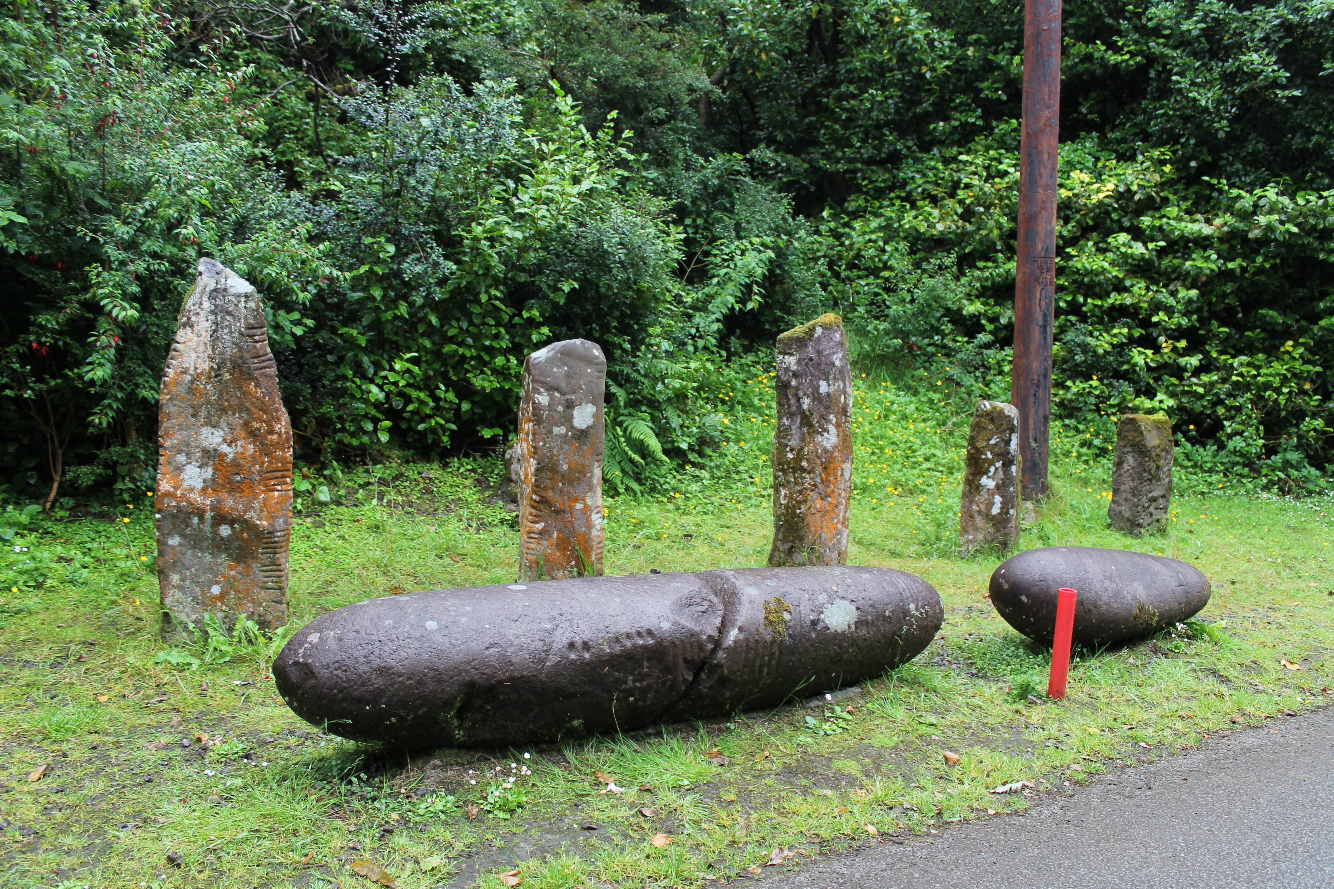
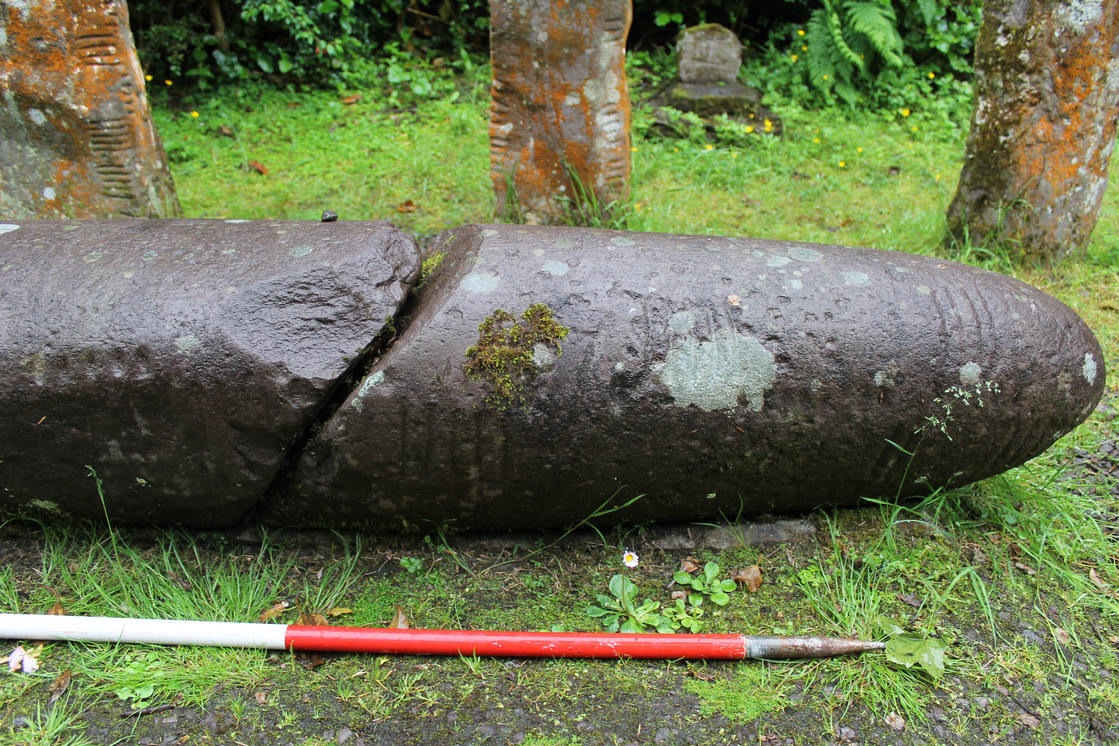
'Sandstone pulvinar', 1.93m x 0.33m x 0.36m (Converted from Macalister 1945, 143). The stone is broken in two and partially flaked away on one side (Macalister 1945, 142-3). There is also a small plain cross on the opposite side of the stone to the inscription.
Text
'Inscription worn, but quite legible, in one line...The fracture crosses E3, in consequence of which this letter has previously been read U ' Macalister (1945, 143). There is no trace of a final -A in the father's name.
Transliteration
Translation
Commentary
This is one of the inscriptions listed by McManus (1991, 94) in which apocope (loss of final consonants or syllables) begins to show itself (MOINENA (earlier -AS), OLACON (earlier -AS)). This suggests that it may be dated to the first half of the sixth century (McManus 1991, 97).
The persosnal name OLACON(AS) is a compound of OL-, possibly OIr. oll 'great, ample' (ogham L can represent L or LL), and -CONAS 'dog, hound, wolf' (McManus 1991, 102, 177 (n.7)).
Locations
Found
When first discovered, this ogham stone stood upright and in tact in the middle of Ballineesteenig village (Macalister 1945, 142), in the townland of Ballineesteenigh and barony of Corkaguiney. (GPS coordinates -10.204740, 52.140119)
Original
Find location probably original site
Last Recorded
In the late 19th century this stone was moved by Lord Ventry to the grounds of Burnham House (now Coláiste Íde), between Dingle and Ventry, where it remains today. The present location of this stone may be accessed via the National Monuments Service Historic Environment viewer on www.archaeology.ie. (GPS coordinates-10.306267, 52.126711)
History of Recording
Discovered in 1790 by Henry Pelham (Collectanea de Rebus Hibernicis 6, 226). 'Sometime before 1804 it was broken into two pieces, and part of the back of the stone was flaked away, as the result of kindling a fire against it. When Brash saw it [1868], it was still on or near its original site', where the pieces served various purposes around the farm prior to their removal to Burnham House (Macalister 1945, 142). This stone was recorded for the Ogham in 3D project in 2017 by Kathleen Reen, a participant on the Corca Dhuibhne 3d project, using Structure from Motion 3d technology.
References
- Bennett I. and Uí Shíthigh B. (1995): Ogham Stones of the Dingle Peninsula. Ballyferriter, pp 7-8.
- Cuppage, J. et al (1986): Archaeological Survey of the Dingle Peninsula. Ballyferriter, pp 250.
- Macalister, R.A.S. (1945): Corpus inscriptionum insularum Celticarum, pp 142-4.
- McManus, D. (1991): A guide to ogam. Maynooth Monographs 4, p. 94, 97, 102, 116, 121, 177.
This work is licensed under the Creative Commons licence Attribution-NonCommercial-ShareAlike 3.0 Ireland
Copyright (c) 2013 by the School of Celtic Studies http://www.celt.dias.ie
All reuse or distribution of this work must contain somewhere a reference to http://ogham.celt.dias.ie/


