CIIC 212. Kilcoolaght East VII, Co. Kerry
Download Epidoc | 3D PDF | 3D OBJ | 🔗 URI https://ogham.celt.dias.ie/212._Kilcoolaght_East_VII

Site Type
Burial ground
Description
Site
'Kilcoolaght Burial Ground/Cill Chuallachta (KE065-003001-): This site is located N of Macgillycuddy's Reeks on slightly elevated ground, a short distance W of the Finglas river. Described as a 'fort' and a 'burial ground' in the OSNB (Killorglin, 38), it is depicted on the first edition of the OS map as a small circular enclosure. It was described by Brash (1879, 228) as 'slightly raised above the level of the field, and about fifteen feet in diameter; it had evidently been much larger, but has been encroached on . . . [It] is an irregular circle without any fence, and stuck full of Dallans, from 12 in. to 4 ft. in height, several of which are inscribed’. Brash also recorded a tradition that a church (KE065-003003-) formerly stood on a rectangular area of untilled ground ‘a few yards from the cilleen'. No trace of this church is now apparent' (O'Sullivan et al 1996, no. 950).
Monument
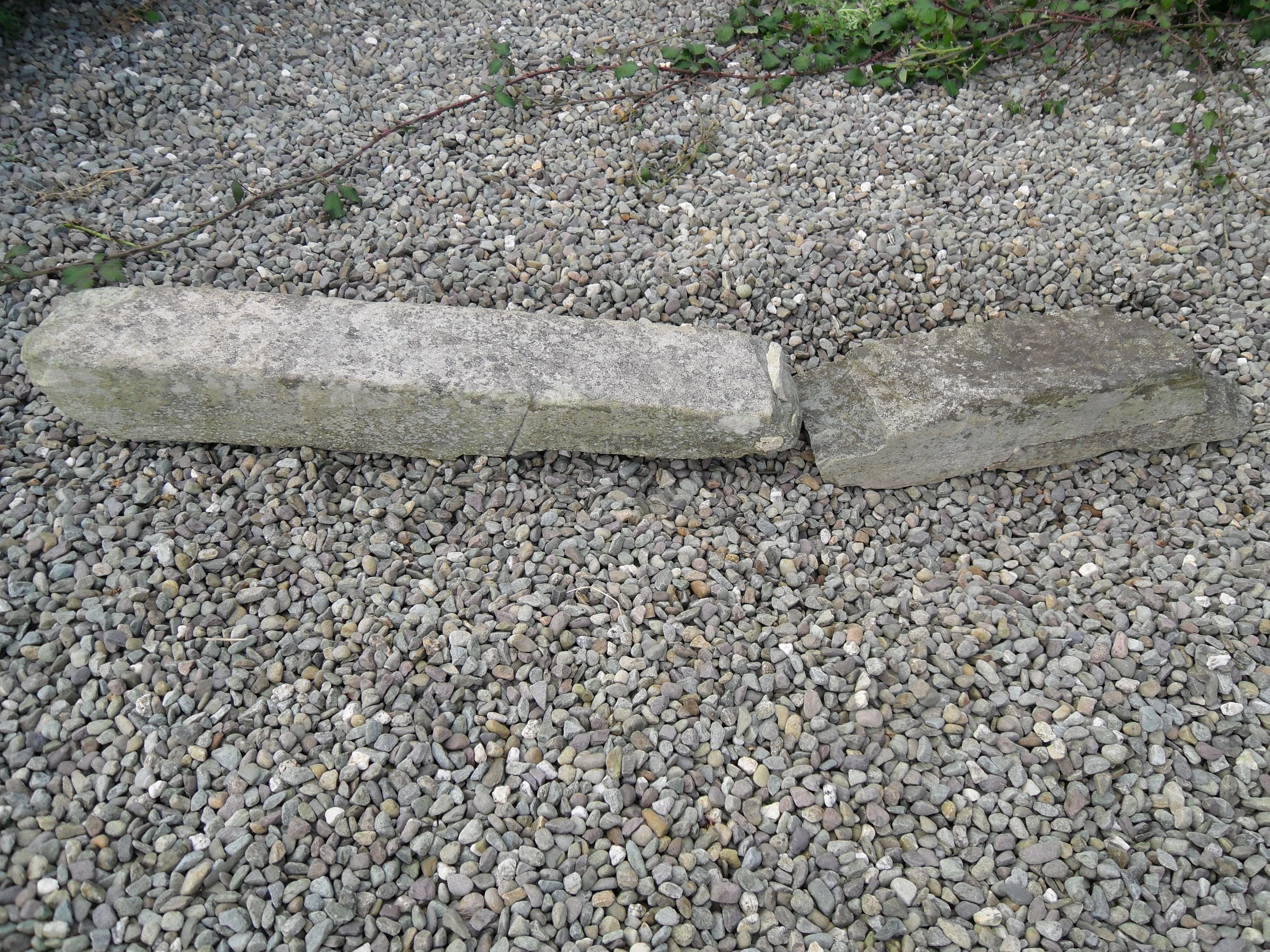
'A fragment of a close-grained straitified stone... with remains of two lines of writing, on angles diametrically opposed'. 0.76m x 0.14m x 0.10m, (converted from Macalister 1945, 205). This and a second fragment (CIIC 210) 'were regarded by Macalister as derived from two separate stones (1945, 204-5). However, both join to form a portion of a single stone that measures 1.24m x .11m x .09m' (O'Sullivan et al 1996, no. 950).
Text
'The H-surfaces of both angles, with the angles themselves, are split away; nothing remains but an L belonging to one line, and the B-half of an M belonging to another' (Macalister 1945, 205).
Locations
Found
along with a number of other ogham stones and fragments in a small area of a field (recorded as a burial ground) in the townland of Kilcoolaght East and barony of Dunkerron North. (GPS coordinates -9.745808, 52.073955)
Original
Find location possibly original site
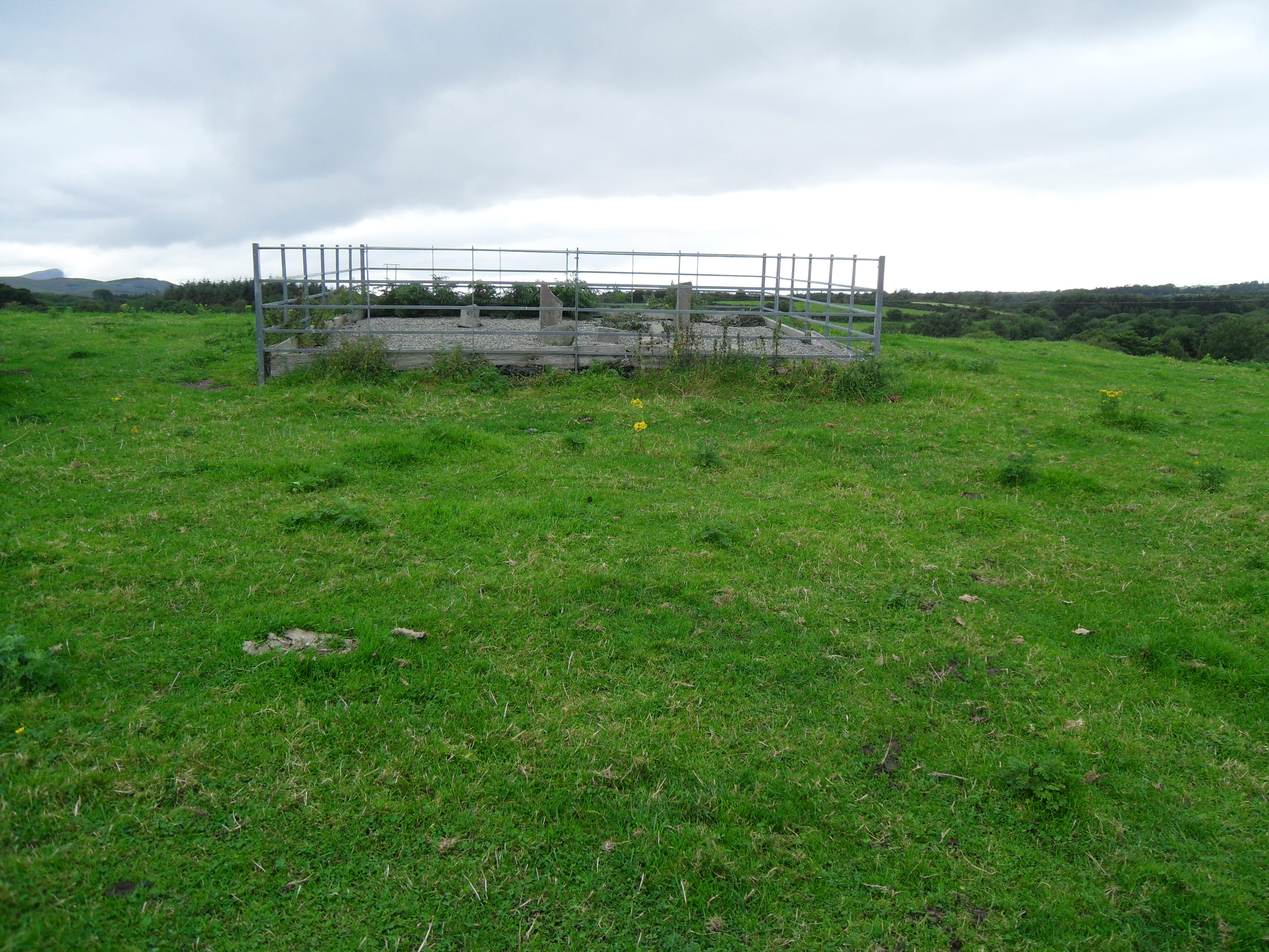
Last Recorded
In a modern enclosure in a large field on private land. The present location of this stone may be accessed via the National Monuments Service Historic Environment viewer on www.archaeology.ie.
References
- O'Sullivan, A. and Sheehan, J.(1996): The Iveragh Peninsula: An Archaeological Survey of South Kerry. Cork, no. 950.
- Macalister, R.A.S. (1945): Corpus inscriptionum insularum Celticarum, pp 205.
Websites and Online Databases
- Gippert, J. (2001): Thesaurus Indogermanischer Text-und Sprachmateriale. TITUS OGAMICA. (3rd edition) University of Frankfurt: titus.fkidg1.uni-frankfurt.de/ogam/frame
- CISP (Celtic Inscribed Stones Project): www.ucl.ac.uk/archaeology/cisp/database/
- MacShamhráin, A.: Monasticon Hibernicum database - Early Christian Ecclesiastical Settlement in Ireland 5th to 12th Centuries: monasticon.celt.dias.ie
This work is licensed under the Creative Commons licence Attribution-NonCommercial-ShareAlike 3.0 Ireland
Copyright (c) 2013 by the School of Celtic Studies http://www.celt.dias.ie
All reuse or distribution of this work must contain somewhere a reference to http://ogham.celt.dias.ie/


