Knockmahon II, Co. Waterford
Download Epidoc | 3D PDF | 3D Textured PDF | 3D OBJ | 🔗 URI https://ogham.celt.dias.ie/Knockmahon_II
Site Type
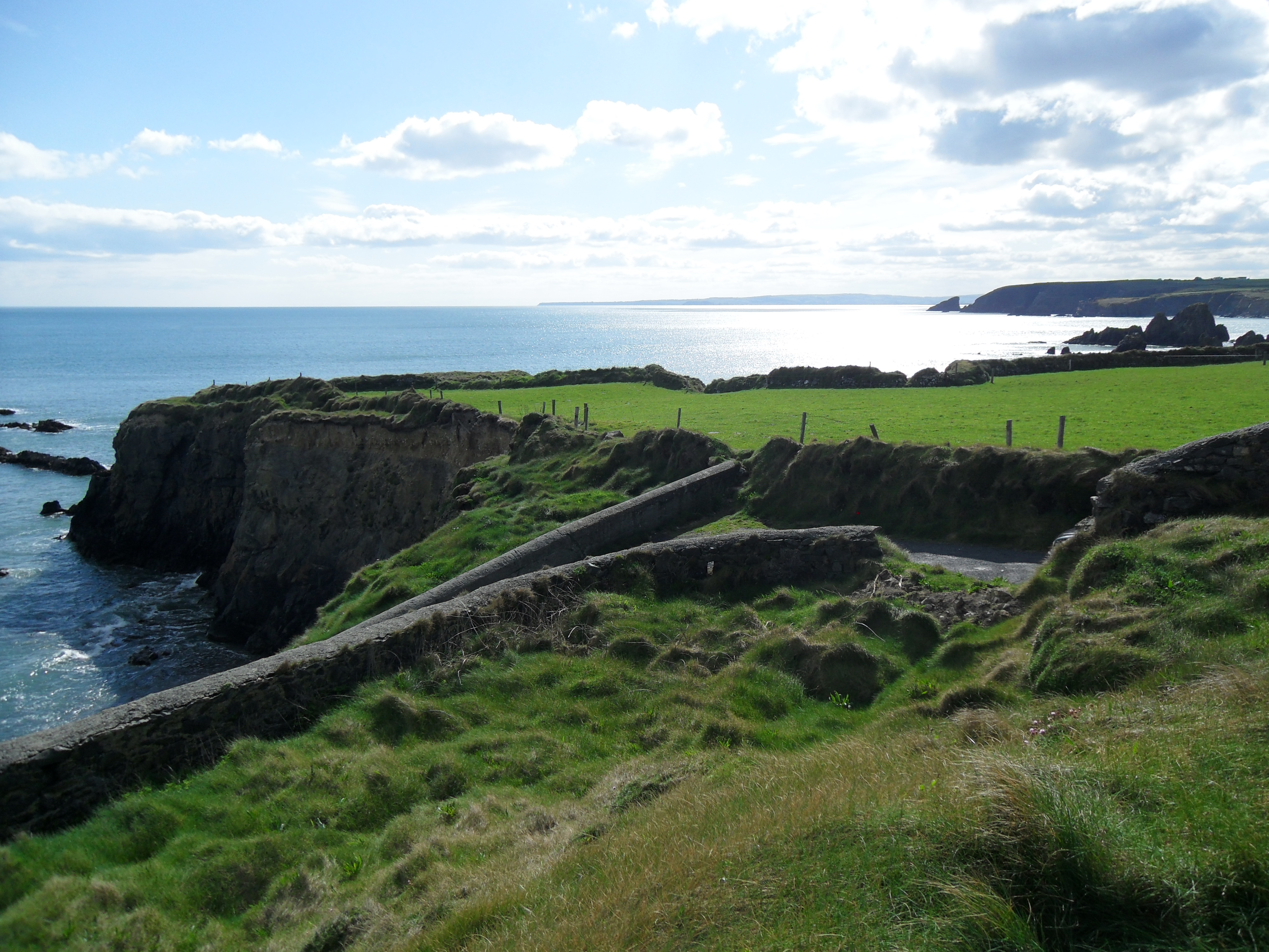
Promontory fort
Description
Site
Small promontory fort with a single bank and ditch. 'Continuing out from the headland and cut off from it and from each other by narrow channels are two tiny grass-topped islands or stacks marked as Gully's Island on the map. These probably formed part of the interior of the fort but have been separated from it by the sea...The area within the bank is at present only 20m long but if the two islands were once part of the interior it would have measured at least 90m' (Manning 1989, 7).
Monument
0.87m x 0.59m x 0.25m (Note: Measurements taken from pdf of 3d data, height = above ground)
Text
This inscription appears to be chisel cut and v-shaped rather than the broader, shallower carving on Knockmahon I, which appears to have been picked with a point chisel.. However, it may be that Knockmahon I is just more weathered than Knockmahon II.
Transliteration
Translation
Commentary
Compare Cloghabrody (Thomastown), Co. Kilkenny: VEDDELLEMETTO MUCI LOGIDDEAS AVVI MUNICCONA and CIIC 206. Kilcoolaght I, Co. Kerry: [C]EDATTOQ[A] MAQI TELEDMEV... (read: VEDELMET[TO]). 'The name of the commemorand is undoubtedly an early form of Fedelmid/Feidlimid, an i-stem derivative of the female name Fedelm (Latinised and Anglicised Fidelma). The third E of VEDDELLEMETTO, therefore, may be erroneous (as Fedelm, Fedelmid cannot come from *Vedelm-, which would have given *Feidelm, with lenited m) [unless] we may have to do here with a svarabhakti vowel' (McManus 1991, 75, n 6. 28).
Locations
Found
in the fosse of the promontory fort ( , ) in townland of Knockmahon and barony of Decies without Drum. The find location of this stone may be accessed via the National Monuments Service Historic Environment viewer on www.archaeology.ie. (GPS: -7.354360, 52.137783)
Original
Unknown
Last Recorded
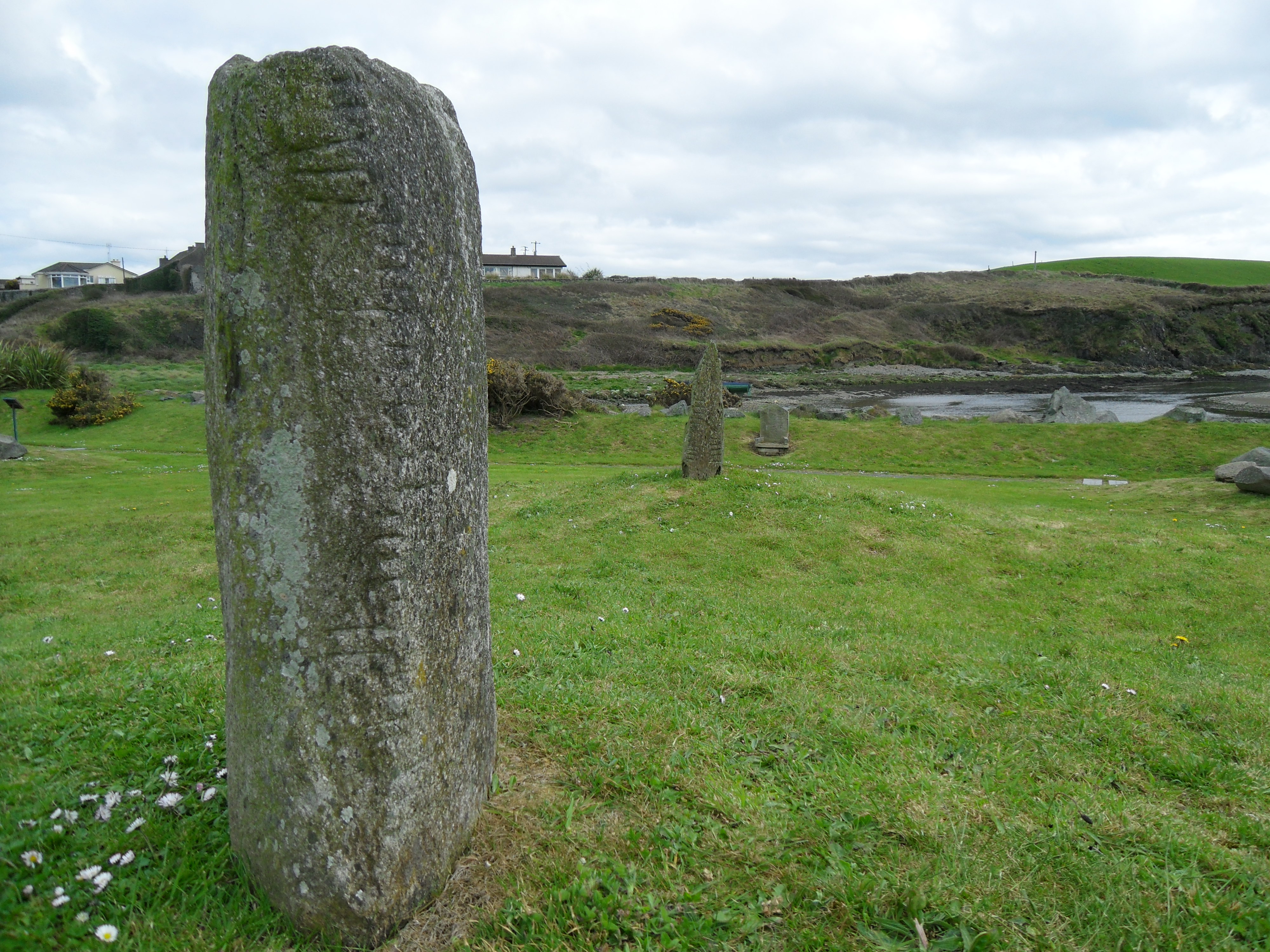
On display with Knockmahon I at Bunmahon Geopark, c.600m from Knockmahon promontory fort. The present location of this stone may be accessed via the National Monuments Service Historic Environment viewer on www.archaeology.ie. (GPS coordinates -7.362428, 52.140308)
History of Recording
Discovered in the late 1990s and recorded by Fionnbarr Moore.
This work is licensed under the Creative Commons licence Attribution-NonCommercial-ShareAlike 3.0 Ireland
Copyright (c) 2013 by the School of Celtic Studies http://www.celt.dias.ie
All reuse or distribution of this work must contain somewhere a reference to http://ogham.celt.dias.ie/


