CIIC 37. Lamoge II, Co. Kilkenny
Download Epidoc | 🔗 URI https://ogham.celt.dias.ie/37._Lamoge_II

Site Type
Ecclesiastical
Description
Site
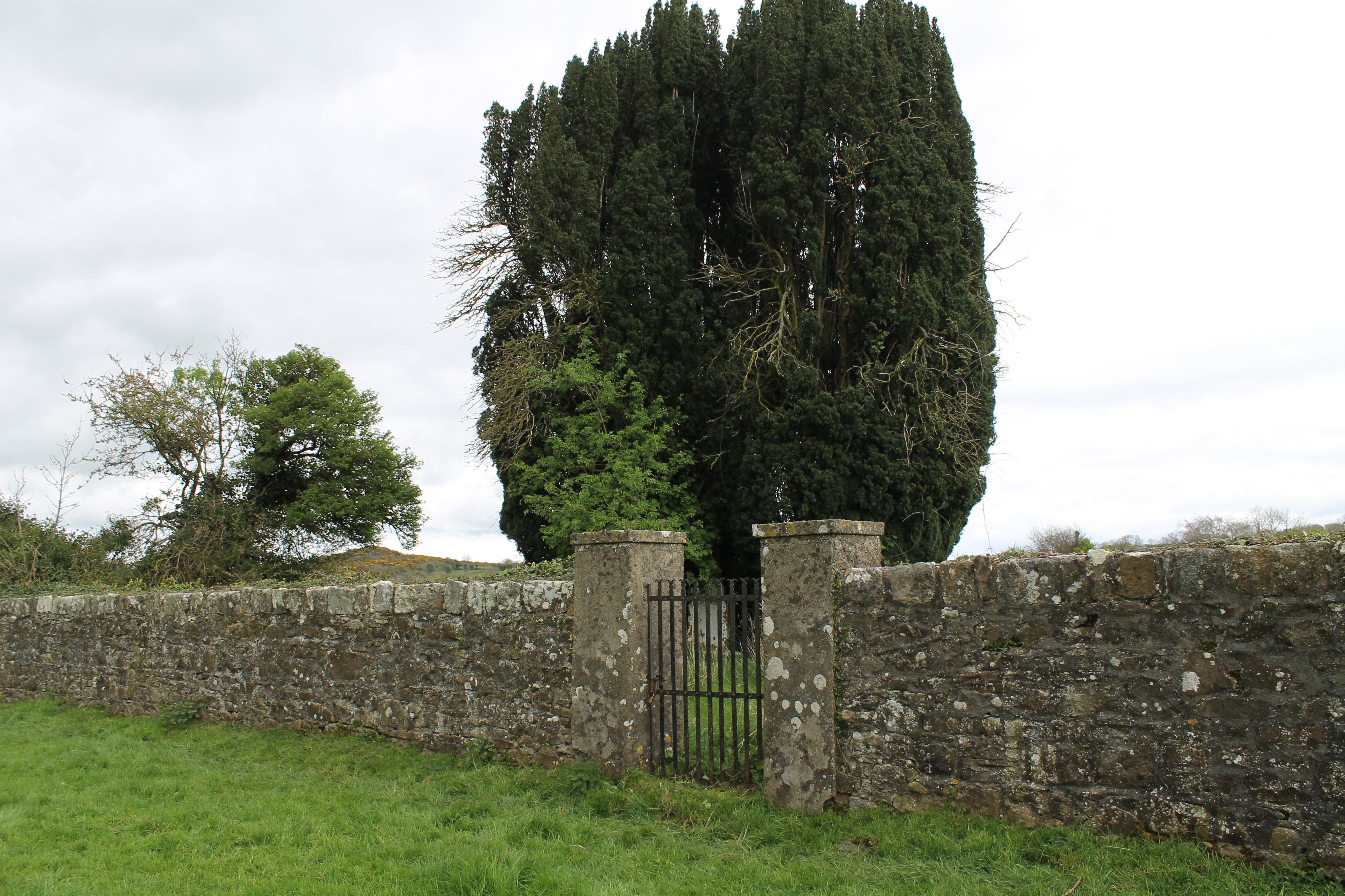
Lamoge graveyard (KK034-013002-) is surrounded by a high, square-shaped enclosing wall with a wrought iron gate. Inside are four mature yew trees and headstones mainly dating from the 1700s as well as smaller unmarked headstones and two ogham stones lying horizontally in the middle of the graveyard. The square enclosure is indicated on the 25" ordnance survey map (1890s-c.1915) and labelled 'church (site of)'. The earlier 6" map (1838-42) shows no such enclosure and is labelled 'church (in ruins), Grave Yd.', suggesting that the enclosing wall was constructed in the latter half of the 1800s, perhaps re-using stone from the ruined church. There is the site of a holy well to the north of the graveyard which also destroyed in the 19th century. This may have been an early ecclesiastical site and is possibly associated with St. Brigit (monasticon.celt.dias.ie)
Monument
One of two ogham stones at this site. 'Greenish sandstone' (Barry 1896, 122). 1.37m x 0.38m x 0.28m, 'tapering to the top, which has been spalled, but in this case before the cutting of the inscription' (Dimensions converted from Macalister 1945, 41).
Text
The inscription reads up-top-down starting at the bottom left hand angle of the exposed face. Macalister (1945, 42) noted that 'a V was incorrectly cut before the initial D, but effaced'. In fact it looks as if this whole angle has been erased and re-cut, possibly because of an error or to replace an earlier inscription. There are traces of scores that don't fit with the main text (DOVATUCI), such as to the left of the angle opposite V, to the left of the final U notch (turning an expected following C into a Q) and at either side of the final I notch (suggesting an M). At the top of the stone, 'the I of AVI runs vertically upward on a ridge between two spall-matrices, at right angles to the line of the inscription', with just 2 or 3 notches barely discernible on the 3d model. 'The first two A's of the second name are set in wide spaces, but there were never any more notches associated with them'. (Macalister 1945, 42).
Transliteration
Translation
Commentary
Although the beginning of this inscription seems to be a palimpsest, or possibly just a correction, the ultimately intended name is clear: DOVATUCI, later the commonly found name Dubthach (dub 'black' + suffix) (Ziegler 1994, 232, 170); http://www.dil.ie/19045. This name is also found in a bilingual inscprition from Clydai in Wales (CIIC 431): D[O]V[A]TUCEAS (Latin: DOBITVCI).
-
On the second angle, the grandfather's or ancestor's name TULOTANAGIA is also quite clear and derives from the adjective toltanach 'willing' (Ziegler 1994, 239); http://www.dil.ie/41353.
Locations
Found
Discovered lying in the graveyard in the townland of Lamoge and the barony of Kells. The find location of this stone may be accessed via the National Monuments Service Historic Environment viewer on www.archaeology.ie. (Private land. Approximate GPS coordinates -7.365943, 52.446598).
Original
Find location possibly original site.
Last recorded
On site in the position in which it was discovered.
History of Recording
According to Macalister (1945, 40) first mentioned in 1891 by Shelley. Barry (1896, 122) notes that he first heard of these ogham stones from Rev. Denis Murphy in 1891 and then again in 1892 from Mr. John Cummins. Barry visited the site and saw the stones in 1892 and again in 1893, when photographs were taken of both ogham stones standing upright. This stone was discovered first, shortly followed by the second, which stood marking a modern grave nearby. Both stones were recorded in 3d (in collaboration with Digital Heritage Age) in June 2020 as an action of the County Kilkenny Heritage Plan Programme, funded by the Heritage Office of Kilkenny County Council and the Heritage Council.
References
- Barry, E. (1896): 'On ogham-stones seen in Kilkenny County', JRSAI 26, pp 122-35. Retrieved June 18, 2020, from www.jstor.org.
- McManus, D. (1991): A guide to ogam. Maynooth Monographs 4, pp 108, 115, 122..
- Nash-Williams, V.E. (1950): The Early Christain Monuments of Wales. Cardiff, N 308.
- Ziegler, S. (1994): Die Sprache der altirischen Ogam-Inschriften. Gottingen: Vandenhoeck and Ruprecht, pp 170, 232, 239.
This work is licensed under the Creative Commons licence Attribution-NonCommercial-ShareAlike 3.0 Ireland
Copyright (c) 2013 by the School of Celtic Studies http://www.celt.dias.ie
All reuse or distribution of this work must contain somewhere a reference to http://ogham.celt.dias.ie/


